Wickedpedia
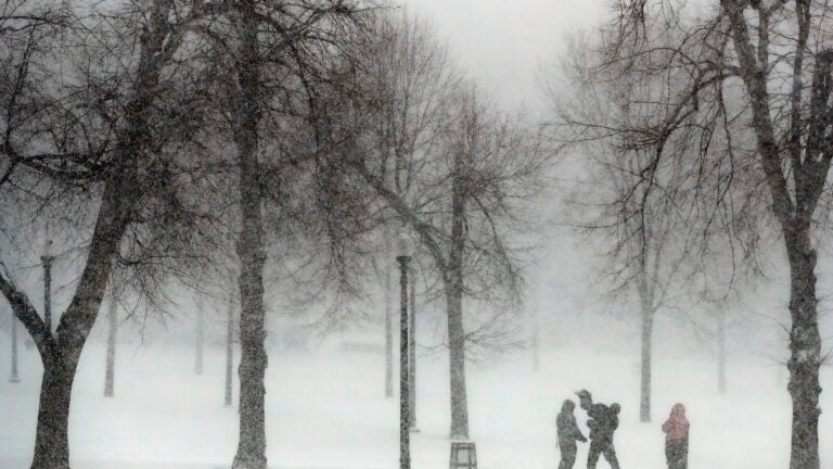
Snow on Christmas in Boston is less common than you might think — even before climate change got bad.

If there’s one question asked every holiday season in Boston, it’s whether we’ll have a white Christmas.
-
Were Boston streets really designed by cows?
No one seems to agree on what exactly defines a white Christmas. The Cambridge Dictionary describes it as “a Christmas when it snows,” but according to Oxford Languages, there only has to be snow on the ground for it to be a white Christmas. The National Weather Service calls a Christmas white if it has “1 inch or more of snow on the ground Christmas morning.”
Regardless, the concept of snow on Christmas represents a sort of romanticized ideal of the holiday — there’s a movie and a song (not to mention all the song’s covers) called “White Christmas.”
“May your days be merry and bright / And may all your Christmases be white,” the song goes.
Well, here in Boston, not all of our Christmases are white. It’s actually not all that common, and even when we have had white Christmases, they haven’t come with much snow.
Probability of snow on Christmas
On average, Boston has about a 19% chance of getting snow on any given Christmas Day, said NBC 10 Boston meteorologist Pete Bouchard, roughly on par with the chances of getting it on any other day in the winter. Those probabilities — based on what days it has snowed in years past — suggest the highest chances of snow on any day is 31%, on Jan. 12.
“So snow on Christmas isn’t too likely, but when you compare the probability for that day to the probability for other days in the winter, it’s not too far off,” Bouchard said.
The last time it snowed on Christmas was in 2017, when Boston got 2.9 inches. Not much, but the record snowfall for a Christmas in Boston is only 3.3 inches.
“You’d think it’d be a foot and a half, two feet, but no, the most we’ve ever had is just over three inches,” Bouchard said. “Having an actual big snowstorm on Christmas Day hasn’t really happened.”
Storms have only occurred around the holiday, such as the blizzard that hit the day after Christmas in 2010.
“Snow on Christmas itself is surprisingly not that common an occurrence,” said Kevin Lemanowicz, chief meteorologist for Boston 25 News.
Historic weather patterns
Since 1936, two Christmases have reached the same high record of 3.3 inches, in 1974 and 2002. Other relatively significant snows include 3.0 inches in 1951, 2.5 inches in 1961, and 1.7 inches in 1996, plus the 2.9 inches in 2017, according to data from the National Oceanic and Atmospheric Administration taken at Logan Airport. There have been only six other instances of snow on Christmas since 1936, all under one inch.
The majority of snowy Christmases, therefore, have been the result of snowstorms taking place in the days before.
Meteorologists define a white Christmas as when there is at least one inch of snow on the ground at 7 a.m. By that definition, Christmas Eve storms and heavy snowfall in the days leading up to Christmas can mean a white Christmas, even if the actual day doesn’t see any flakes fall. (And using that parameter, the last white Christmas was actually in 2009, since the snow on Christmas 2017 started falling after 7 a.m.)
“There’s some discrepancy between what the public might perceive as a white Christmas and what meteorologists’ records will define as a white Christmas,” Lemanowicz said.
Snow falling the night before is also beneficial from a temperature perspective. The average temperature around Christmas is about 40 degrees, so it’s mostly the lows that are getting down to below freezing.
“If you get a storm to come on Christmas Eve, and it snows overnight when it’s coldest, you can get yourself a white Christmas,” Lemanowicz said.
How weather is changing
The warmest Christmas on record was in 2015, when the day hit 62 degrees. Even more recently, in 2020, it was 60 degrees on Christmas.
“The climate, no doubt, has warmed up,” Lemanowicz said. “The numbers don’t lie.”
Those temperatures are a significant increase from 40.5 degrees, the average maximum temperature for Christmases since 1936.
“I think of that as the old climate; the new climate that we’re in now is completely different with a completely different set of stats,” Bouchard said. “Nothing is normal. Things are off the charts.”
As climate change progresses, he said, anything could become “fair game.”
“You could have thunderstorms on Christmas Day, you could have a blizzard,” Bouchard said.
In Lemanowicz’ view, the seasons are shifting later, meaning in recent years it’s stayed warmer into the fall and early winter but then remained colder into spring, which means snow patterns would be shifting the same way.
“If the seasons are indeed moving forward as I perceive them to be, that means there’s even less of a chance of having snow on Christmas Day,” Lemanowicz said.
Unlikely to see white this year
Although Bouchard didn’t rule it out entirely, he isn’t optimistic about the chances of snow this Christmas. He described our current weather pattern as “crazy, with a lot of weather systems coming through,” referencing the alternating cold snaps and warm spells that have been lasting a few days each.
“It’s been repeating like that for two weeks so I expect that to continue through Christmas,” Bouchard said. “If we land on the colder side, we could get some flakes, but the chances are pretty low. I think the chances are better that we’ll be above normal in the 40s to 50s.”
There’s a small chance of snow prior to the holiday, Lemanowicz said, around Dec. 20, but he doesn’t think it will be enough to last through Christmas.
“Things can always blow up within a couple of days, so it’s tough to say for sure, but as of now it looks like it won’t be major,” Lemonawicz said.
The Weather Channel predicts a high of 39 degrees and a low of 25 degrees for the day, with partly cloudy skies and a 24% chance of precipitation.
Boston.com Today
Sign up to receive the latest headlines in your inbox each morning.

