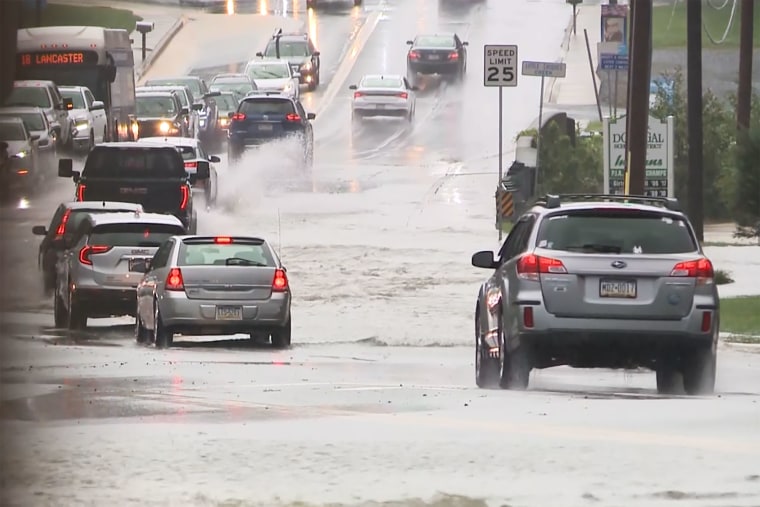
Torrential rain and thunderstorms are expected to threaten much of the eastern and central United States with flash flooding throughout the rest of this week, forecasters warned, as parts of the country, from Texas to New Jersey, continued to battle fast-rising floodwaters on Tuesday.
Almost 90 million people are under some form of storm warning or alert, including much of the East Coast, with strong to severe thunderstorms possible over parts of the Central High Plains and portions of the Great Lakes as a “potent summer storm system” moves through central states.
Metro areas, including New York City, Washington, D.C., Philadelphia, Pittsburgh, Cleveland, and Columbus, Ohio, will all be at risk of localized flash flooding on Wednesday night into Thursday, meteorologists at AccuWeather warned.
Florida is bracing for more heavy rain from a low-pressure system that is moving west across the Gulf. The tropical disturbance, designated as 93L, has a 40% chance of developing into a tropical depression in the next few days. In any case, it will bring up to 10 inches of rain to the Florida Panhandle and across to Louisiana.

“Slow-moving thunderstorms with torrential rain are a frequent trigger for flash flooding in the United States, especially during the warmer summer months when the amount of moisture in the atmosphere peaks,” AccuWeather Vice President of Forecast Operations Dan DePodwin said.
In Maverick County, Texas, southwest of San Antonio on the Mexico border, first responders rescued 47 people from the Quemado area, and multiple roads were shut. Disastrous flooding has devastated the nearby Texas Hill Country in the last week and killed at least 134 people.
Social media images showed downed trees, high waters, and storm damage in Illinois, Minnesota, South Dakota, and Iowa on Tuesday.
Two people were confirmed dead in Plainfield, New Jersey, on Tuesday as firefighters responded to emergency calls from people trapped in vehicles swept away in fast-rising floodwaters.
Heat warnings and fire risk
Widespread heat warnings are also in effect across eastern parts of the country, from the East Coast to the Lower Mississippi Valley, as temperatures rise into the 90s. The warnings indicate “a level of heat dangerous to anyone without access to air conditioning or adequate hydration,” the NWS said.
Temperatures are expected to cool down by Thursday as a new cold front moves into the interior Northeast.
But hot conditions persist in the western states, and an elevated to critical fire risk is in place across the central Great Basin, with the chance of dry thunderstorms.
Washington Emergency Management issued a red flag fire warning for seven counties, including those at elevations of 1,500 feet above sea level. “Now is the time to take steps before a wildfire comes your way. Clear woody debris around your home and make sure you have go bags ready,” the agency said.
