
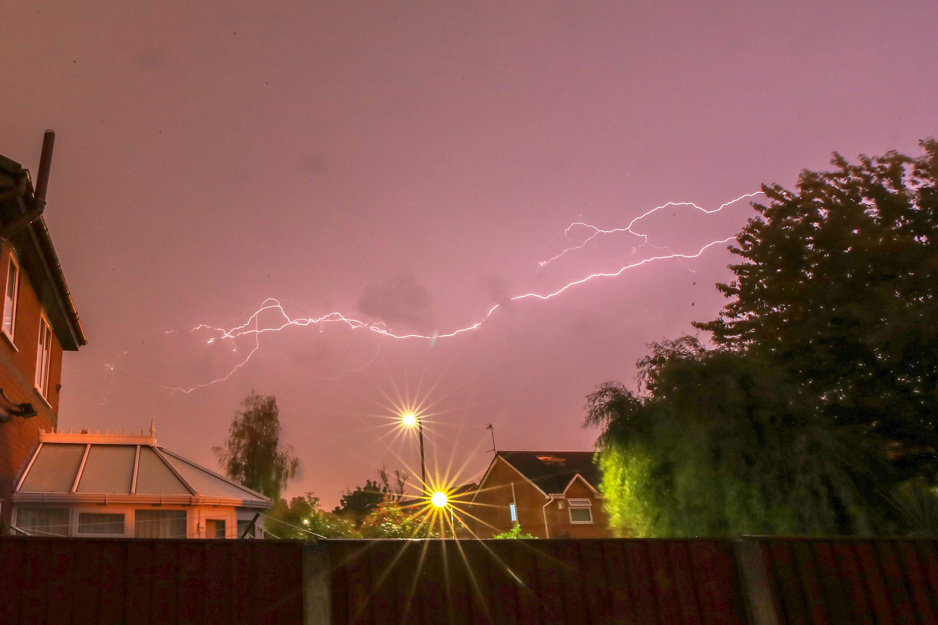
Flooding is expected to wash away the warmest spring equinox in more than 50 years as thunder storms traditionally associated with summer are brought forward by climate change, the Met Office said.
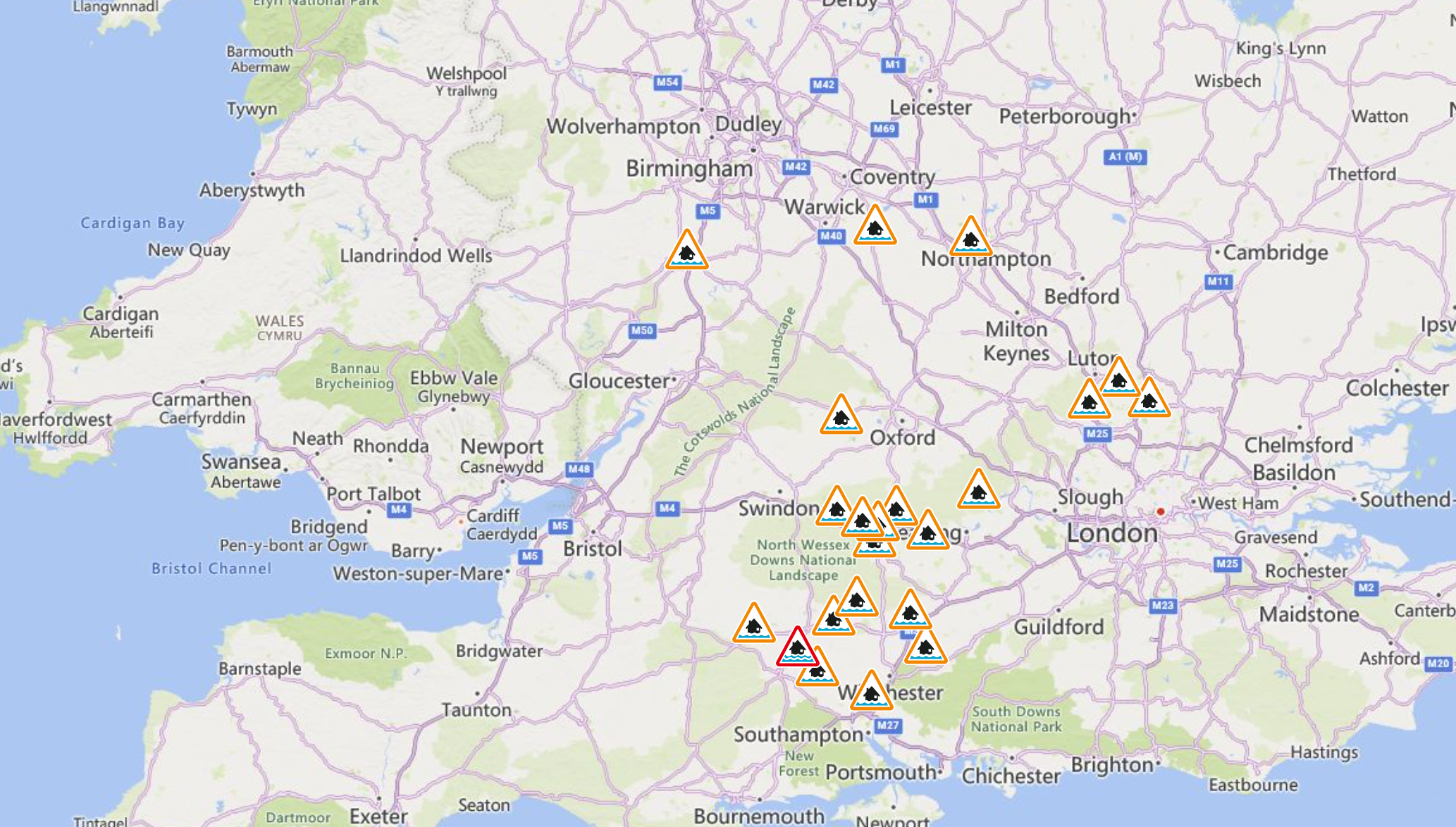
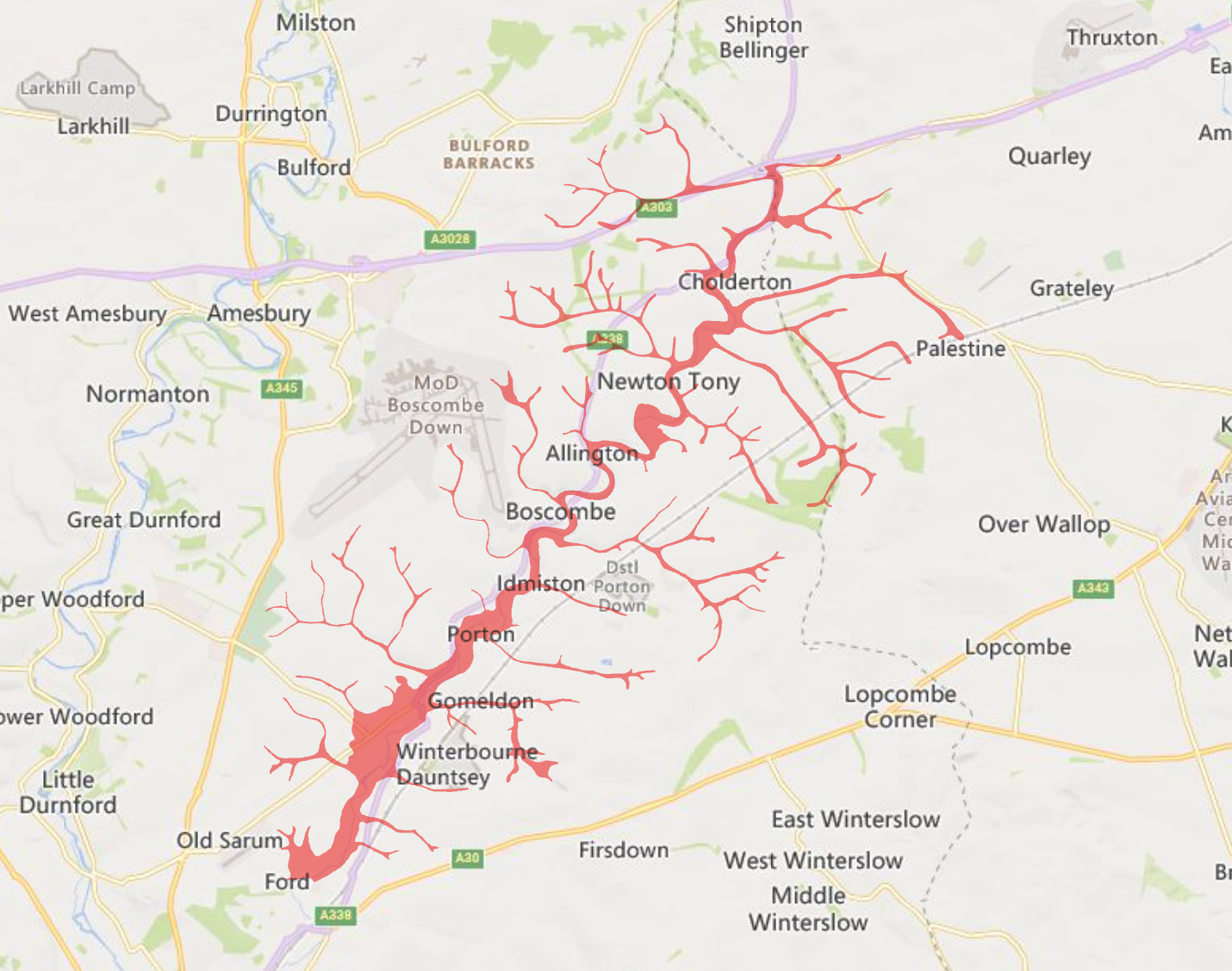
21 flood alerts, where flooding is deemed possible by the Environment Agency, are in place across the south west and Midlands, with flooding expected in the Bourne Valley, Wiltshire. Frost is expected to return to rural areas as temperatures plunge overnight.
The Met Office told travellers to “take care” as “there could be some localised flooding in places” days after the UK saw its warmest spring equinox day since 1972 on Thursday, with temperatures reaching 21C.
The latest groundwater level recorded in Clarendon was 70.98m, with property flooding possible when it goes above 70 metres.
Despite the warm spring weather, the National Highway had to close parts of the M18 in Yorkshire to clear floodwater on Saturday following heavy rain.
Jonathan Vautrey, a meteorologist at the Met Office, said: “For this time in the year, it is rarer to have such intense storms. This is happening because we have had a lot of warm weather of late and temperatures are notably above average for the time of year.
“We’ve had highs reaching over 20C over the last few days, and we were up to 18.5C as the high today as well, where we should be more around 10 or 11C.
“That sort of heat that we’ve got around at the moment has really helped to spark off some of these thunderstorms, and a lot of moisture being drawn in with this sort of low-pressure system that’s been arriving across the UK.”
Mr Vautrey added that the climate crisis will see summer storms come earlier each year.
“We’re constantly seeing warmer temperatures at earlier points of the year compared to where they normally are.
“These sort of intense summer storms are then increasingly going to happen at more points in the year because we’re getting those temperatures in there to really allow them to start developing.”
The Met Office said it would be a cloudy start on Sunday, with rain in the north and east slowly easing later in the day.
The forecaster predicted sunny spells in the northwest and southeast, with showers soon “bubbling up” in another mild day with above-average temperatures for most of the UK.
Senior Operational Meteorologist at the Met Office Ellie Glaysnor, said: “We are not expecting too much change in the temperatures throughout this week, with mid to high-teens in sunnier conditions, but in frontal cloud temperatures nearer average (low to mid-teens).
“There is still a risk of overnight rural frost in clearer spells, with temperatures generally down into low or mid-single figures for most.
“Areas experiencing frontal cloud overnight will see temperatures hold up in high-single figures, if not low double figures, at times.”