
Residents in Port Hedland, Western Australia are feeling relieved this morning as Cyclone Zelia made a last-minute pivot away from the area, avoiding a direct hit.
Zelia made landfall an hour’s drive away from the area, hitting a cattle station as a category four storm.
However, the cyclone did still bring intense rain and winds, with trees uprooted, roads flooded and homes damaged in Port Hedland.
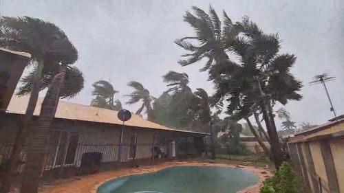
Some parts of the region have seen 500mm over the past few days.
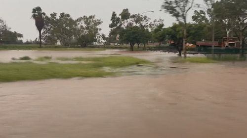
Emergency warnings for the area have now passed, however serious flooding is expected due to the sheer amount of rainfall.
The SES has already received 60 calls for help and they are expected to be inundated as the sun rises over the west coast.
Zelia is slowly dissipating over the Pilbara region and is moving south at 8km/h, according to the Bureau of Meteorology.
However, it will bring intense rain and possible floods over the area as it moves south, as well as in western Kimberley and northern Gascoyne.
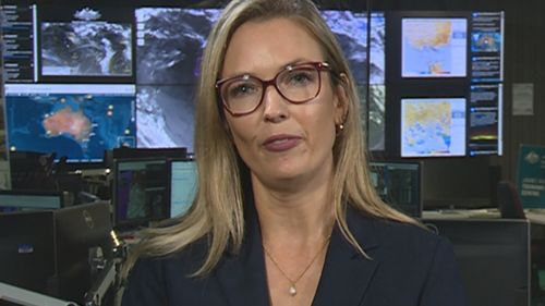
The Bureau of Meteorology senior meteorologist Sarah Scully said continued rainfall up to 120mm is expected over the next 24 hours.
“At the moment the Greys River is in major flooding and some of the river heights are continuing to rise,” Scully said.
“With the rain still falling across the area the flooding impacts continue, even though the winds have eased below gale force.”
The storm got weaker as it made landfall, and it’s expected to weaken further as it keeps moving inland.
“The Tropical Cyclone Zelia has weakened to a tropical low overnight,” Scully said.
“It has moved southward, so it’s no longer attached to those warm waters of the Indian Ocean so it has weakened below tropical cyclone strength.
“We are expecting heavy rainfall impacts to continue and potential flooding.
“That system is now expected to move southwards and drag with it that tropical moisture [as well as] the moderate to heavy rainfall into southern parts of WA.”